NISAR-Ready Vector Intelligence
Satellite-assisted habitat and human-exposure prioritization for field inspection, with an explicit roadmap for entomological validation.
Explore GeoAI ResearchSaptrishi Research develops transparent, field-oriented methods for community medicine. Current programs include NISAR-ready GeoAI for vector surveillance and deterministic reconstruction of objective resting ECG and treadmill-test measurements.
Each program publishes its intended inputs, mathematical or computational method, validation status and scientific limits.
Satellite-assisted habitat and human-exposure prioritization for field inspection, with an explicit roadmap for entomological validation.
Explore GeoAI ResearchA deterministic protocol that converts a resting 12-lead ECG and treadmill-test report into auditable objective measurements, without diagnostic prediction.
Open Cardiac Protocol Secure Report IntakeThe prototype turns environmental and human-proximity signals into inspection priorities while keeping field evidence at the centre of every decision.
Prepared by Abhishek Dubey, the project is designed to evolve with L-band and S-band SAR inputs. Its operational goal is deliberately practical: help field teams decide where to inspect first after rainfall, complaints or seasonal vector-control alerts.
Satellite-context comparison and inspection-priority surfaces are ready for structured field validation.
Next milestone Field evidenceRead wetness, seasonal surface change, vegetation, terrain and nearby human-exposure signals.
Identify which lanes, drains, plots or peri-domestic spaces may deserve inspection first.
Use the map to guide field checks, then compare model priorities with observed habitat and mosquito evidence.
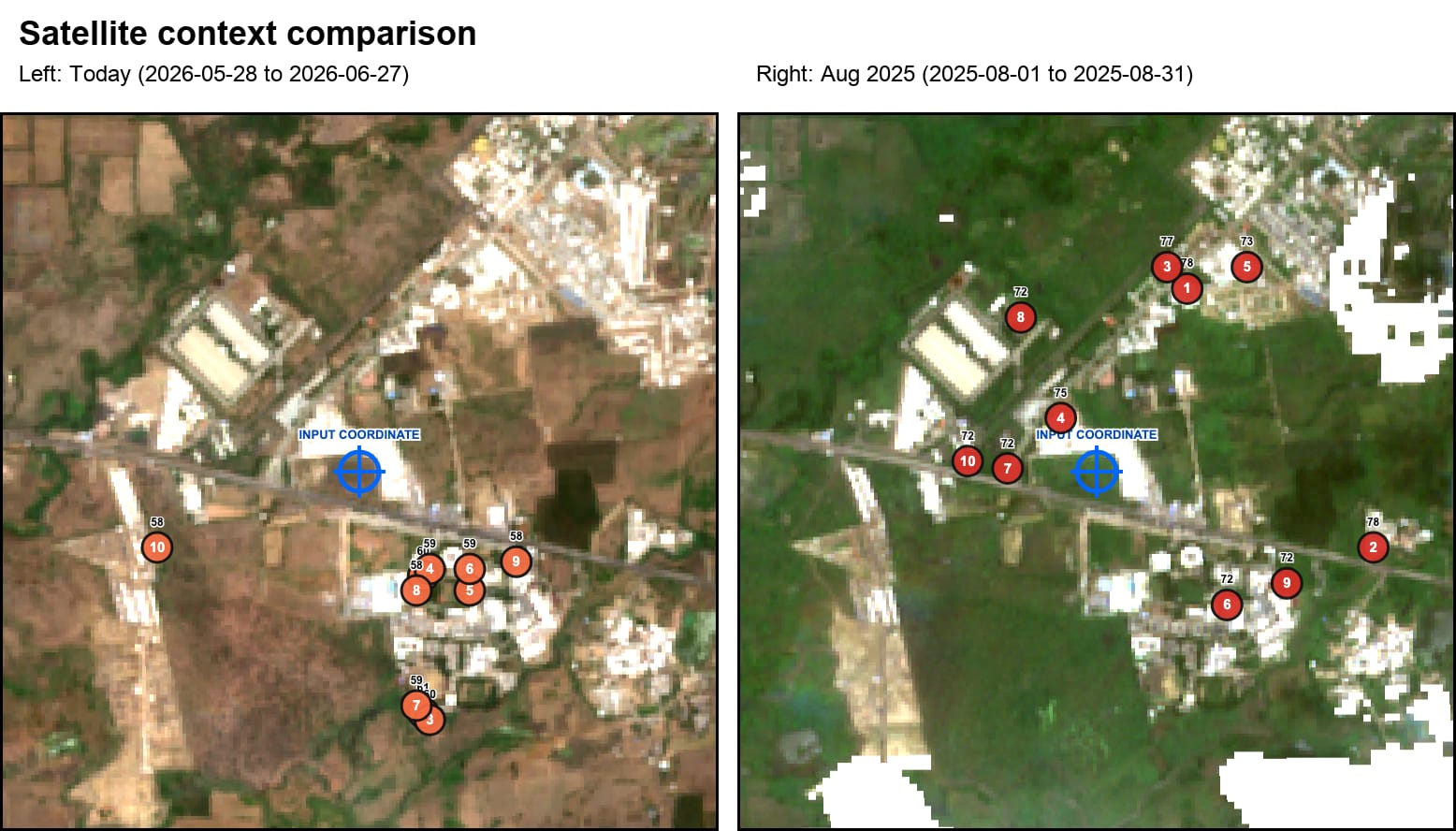
Satellite context is translated into adjusted exposure surfaces and local inspection points, creating a practical starting point for field teams.
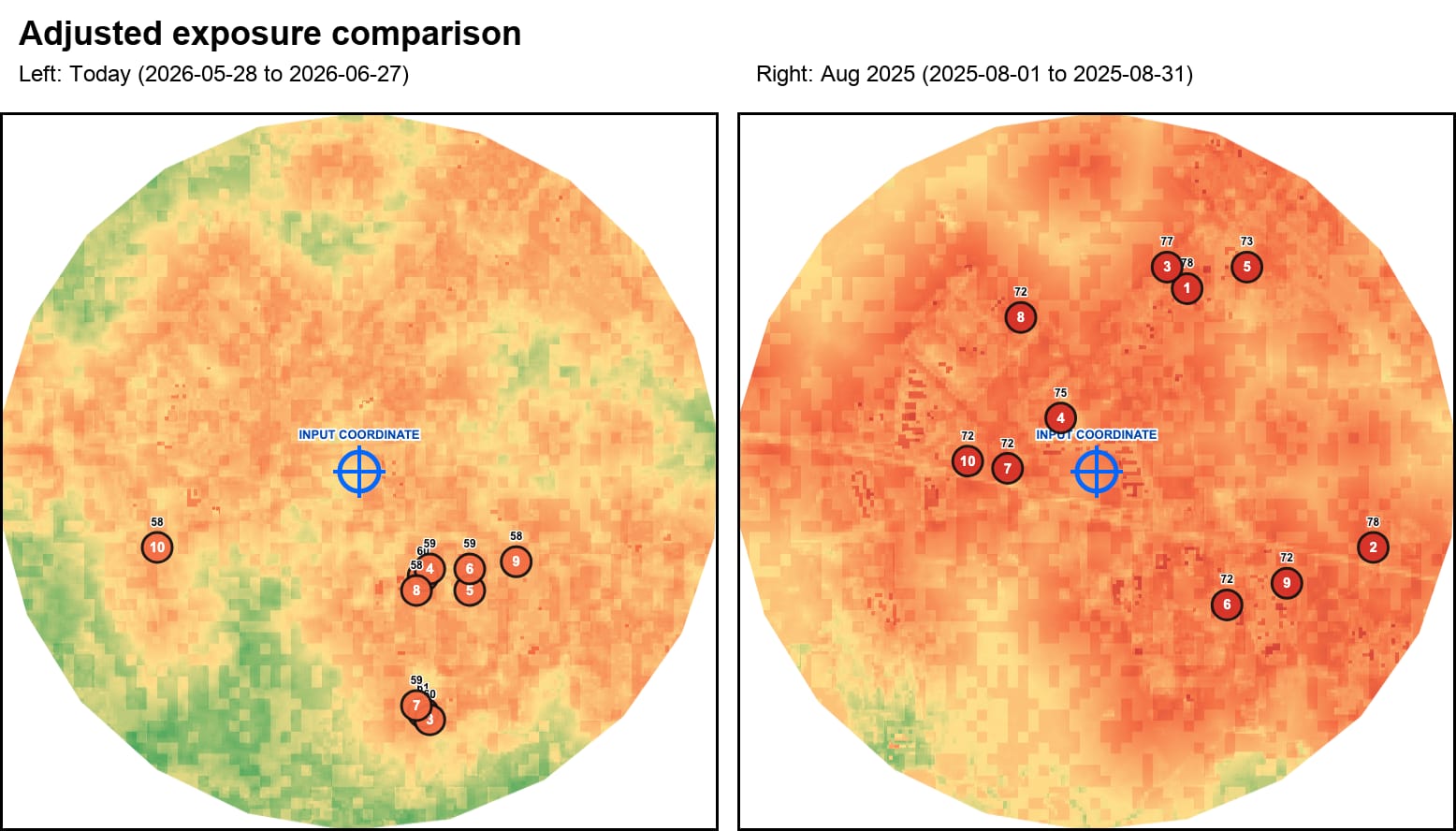
These maps demonstrate the inspection-priority workflow. They are not presented as NISAR-derived disease maps and do not confirm larvae, adult mosquitoes or disease transmission without field validation.
This short concept video introduces the project’s central idea: use AI and geospatial signals to make public-health inspection more focused, while leaving decisions with qualified field teams.
Synthetic Aperture Radar can observe land surfaces day or night and through cloud cover. That makes it especially relevant during monsoon and post-rainfall periods, when optical imagery may be limited.
The model is an inspection-priority prototype. These validation steps must come before any early-warning claim.
Inspect high, moderate, watch and low score points for stagnant water, larvae, pupae, adult mosquito evidence and habitat type.
Compare Aedes-oriented outputs with House Index, Container Index and Breteau Index where field surveys are available.
Use ward or locality-level case data with rainfall and temperature lags before calling the system an early-warning model.
We welcome serious students and early researchers who want exposure to applied AI, public-health data, geospatial analysis and field-oriented product thinking. Interns may contribute to literature review, dataset preparation, validation planning, map interpretation, documentation and prototype testing.
Share your background and the area you want to work on. This form is for research internships, academic discussions and field-collaboration inquiries, not student test enrollment.